|
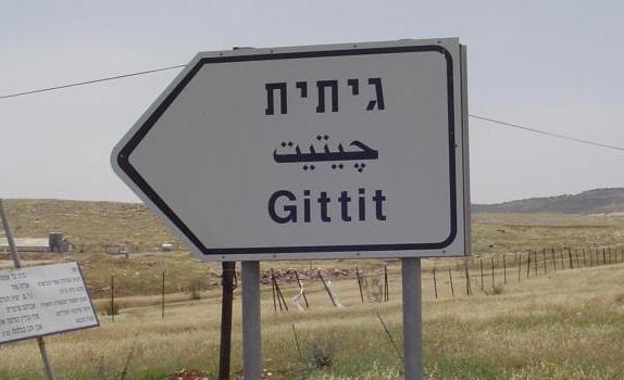
Moshav Gittit (Gitit)
Last updated 23-Apr-2006 |
Related links: |
 |

|
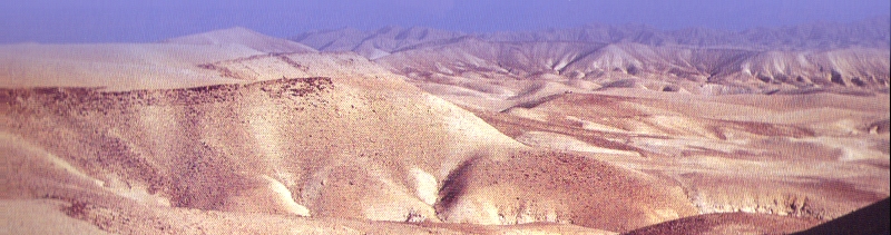
About the Moshav... Gittit is a great place to live in quietly, to walk around, see the sunset behind the palm trees, hear the water being spread over the fields, smell the clean air with the smell of wet ground. Moshav - is a small nice village/settlement in Israel. Moshav Gittit was first established at 1975, by a group of NAHAL warriors armed with high motivation and long hair. The moshav is located in the Jordan Valley, on the back of Samaria (Shomron) mountains. Not really deep in the Jordan Valley hence the temperatures are not so high in the summer (don't get me wrong, it is still very hot here) and not too low in the winter. just great ideal weather. The Moshav enjoys a great view of the Jordan Valley, the tub (ambatya in hebrew) and the Sartaba. Fresh air and open fields. The Moshav was established by BEITAR and the Jewish Agency and was in the bigining a secular moshav. Today it is a normal Moshav with central community, and belongs to Jordan Valley Municipality. The moshav is located near Local Municipality of Maale Efraim and there for enjoy a close school and other community services (as much as they have...) The idea of establishing the Moshav had came from Zionist ideas of loving Israel and fulfilling the idea of Zionism and agriculture. At the early days of the Moshav it was based on agriculture and most of the resident were actually farm workers. The moshav is located next to an area called "The Tub" which is a small valley that promised good irrigation ground and most of the fields are located there. There are grapes for eating, palm fruits and some vegetables. Closer to the Moshav there are green houses of flowers, roses, gipsanit and bird flowers. On it's top size the Moshav held 30 families but today only 20 families lives in. Inside games and fights between the "central community" and bad actions have made lots of nice families to leave. Also agriculture is not the best work to hold today, and most of the people works outside in the city. This is now the situation all around the country. But still there are a few people that work at the fields those days. (oh if we all could earn some money from agriculture we would have leave this High-Tech and move to be Shepard’s walking on the mountains towards the sunset) Gittit is (and could have been more) on of the most beautiful moshavs in Israel. It’s have great view and it is a great place to grow up in. It is not really down in the Hot Jordan Valley, but only 10 minutes of driving from the Jordan River itself. It is one hour of driving to Tel-Aviv (120Kmph if you are not getting caught, without traffic - 'till glilot junc’) and only three quarters of the hour from Jerusalem (if nobody shoots on you), so it is a bit more open to the outside world than the other moshavs in the Jordan Valley. Between us, only in Israel this kind of Moshav is considered far away, you should go to Argentina to see what really far away is. Above Gittit there once was a military base, but on those days they went to play somewhere else. There is also a small nice monument on a hill next to Gittit, not famous one and really beautiful to walk around at the evening. There is another nice memorial monument lower in the Jordan Valley next to Pazael (around 612 seconds driving from gittit), but i will talk about it later. |
|
About the name Gittit (gitit): Gittit appear in the Jewish Bible (Tanach) as a music instrument. (Give me a few day and i will check it out). Ok, so a girl named Gittit saved me the time and she says: That the name Gittit appears in the bible three times: Tehilim: Chapters: h, pa, pd Thanks Gittit |
|
|
About the people: Don't ask me, and i will not answer. But there are some that i like. |
Dir , on the jordan river bench, about 20 min from gittit. Dir - means Monestery / Monk in arabic
|
History of the place: Gittit appears in the bible as a music instrument (de ja vou). History of the place: Biblican fights: (wow i have a lot of work in the library) The Sartaba - The highest mountain in the Jordan Valley Six days war The country hunting rode History of Gittit: Gittit was established by a group of NAHAL from the IDF, full with motivation and proud with the zionist country on 1975. Among them where parents, who carried and worked this idea. When the time passed more familes have arrived (dripping) that wanted to settle our small butifull country. Some of them stayed and get growing in our small moshav. But a special mechanizim of chossing was made, and as usually it this kind of mechanizms, it was working very good to explain some of the good ones that came, that they are not welcomed and keep the rest. Somewhere in th 80s Alon road was made that connected Gittit with the center to Tel-Aviv, and created also a better easier way to get to Jerusalem. But still the people of the Valley continue to use Jericho way, or Jericho By Pass. In the moshav we had a small grocery store but it got closed... We have a small nice swimming pool and a basket ball yard where my father is playing basket ball every friday with the youth of gittit View the Gallery 2006 how the moshav is today |
|
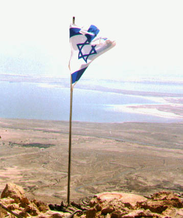
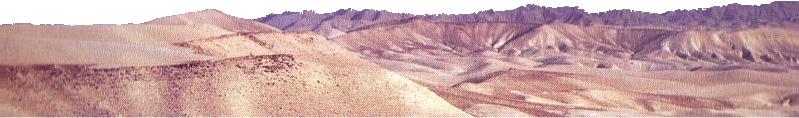
Geographic Location: So as i said before: Gittit is in the middle of Israel from north to south, On the east side of Israel close to the Jordan River and the Jordan Kingdom Border. Gittit enjoys great air and view of all the jorden valley, in a good day you can see all the way down to the Dead Sea and Jericho. Near by communities: North: Hamra, Mechora, and if you go more to the north you get to Bet-Shean valley on Alon rode and up to the "kineret" sea of galile. South: over the Jordan Valley road Maale efraim, Pazael, Netiv Hagdud and more ... East: Yafit, Gilgal but only by a 4x4 road. Also the Jordan River and Country Jordan (and Japan...but it's far far away) West: Migdalim that belongs to Binyamin shaire. Ariel, Tapuaj Junction and Rimonim that is not so far away but the children learn in Maale Efraim and i don't know why. |

|
|
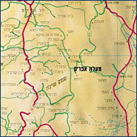
The connecting roads: Alon road from Jerusalm and Shomron pass from Tel-Aviv, which are going down to gittit junction with great curves for motorcylces (just be carefull). They are connected to the Jordan Valley Road and continue with Alon Road up north. Buses: Only a few. 949 - Egged, sometime passes in Gittit, i'm not even sure he knows when. 161 - Dan, get to Gittit Junction (3 Km from Gittit) so you can walk but it's a bit far, or go all the way to Maale Efraim, and buy ice cream over there. Maps (lots of them): Just for you to understand on which area on the globes we are talking about All the country (Flags Flags) General Roads Special Roads The area Air photo of part of the Jordan Valley Map of Gittit (removed for security reasons) |
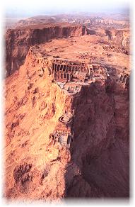
Metzada - an historic site of old battle with the romans
|
Recomendations: Just to walk in Gittit at night. To go down to the "Tube" after they gave water to the agricultures areas. To see the sunshine from the Sartaba. Go down to the monument memorial next to Pazael. To go on a 4x4 way around the Jordan Valley, i will be more than happy to give some recommendation, since i was traveling all the area much. It is a very beautiful part of the country but it is not travelled much and it's a shame. Anyway you need to go in a large group and synchronize it with the army. View the Gallery 2006 how the moshav is today |
|
Contacting Gittit (gitit): Moshav Gittit Bikaat Hayarden D.N. Mizrach Binyamin 90645 Phones Reception: 02-9941212 Security: Jewish Agency (they are really alright lately): Beitar: |
|
|
The Sartaba and the Jordan Valley Memorial Monoument: The Sartaba: (Alexandrion) The Sartaba is the highest mountain in the Jordan Valley, in a nice day usually at winter after some good rain; you can see Moav Mountains and the Dead Sea. (and from the balconey of my room you can too). On top of it there is some old ruins of an old palace that hordus had build for one of his wife, there are lot's of great stones in the shape of hearts. On the days of the Bar-Cochva they where lighting fire on top of it. And on our days, PALSAR NAHAL finishs their rookie part with a short ceremony over there. Another name for the Sartaba is Alexandrion. Most of the archiologiest belives that this old castle where built by Alexander Yanai. Jordan Valley Memorial Monument: Beautiful nice and quite place that was made for soldiers who died protecting the Jordan valley on the wars of Israel Since the 70s the Jordan Valley (Bika'at Hayarden) is known as The Persuit Land (Eretz Hamirdafim) in the memorial of the many persuits made after terrorists that came from the jordan kingdom. Im honor of the solider who died in those combats a Memorial Monument was made by the sculpture Igal Tomarkin. In this view site in the center of the Jordan Valley listed all the names of soliders died since 1967 protecting the Israeli Jordan Valley. You can see from here on the north Moshav Yafit and the Bikaa meeting point. On the south Moshav Fatsael and the small spring of Fatsael. On the east you can see the Moav Mountains and the Kingdom of Jordan. View the Gallery 2006 and the sartaba pictures |
   |
|
News: In the Mifal Hapayis and the Jordan Velley council - short stories contest - 'Katuv', two story won, by my sister and me: My sister story: Jeep Tour My Story: The Debugger |
Books:
|
A History of Israel: From the Rise of Zionism to Our Time |

|
Six Days of War: June 1967 and the Making of the Modern Middle East |
|
About me... I was born on 1975 in Gittit and raised in Gittit all my life And I'm still here today You may contact me, or just come to visit Please look in the links area for some more information View the Gallery 2006 how the moshav is today, and also my house Read stories i wrote. |
 Salar Bolivia, May 98 Cnaan |
(C) Copy right 2009
|
Underdog Projects |
c2kb.com |
SwiftCoding.com |
|